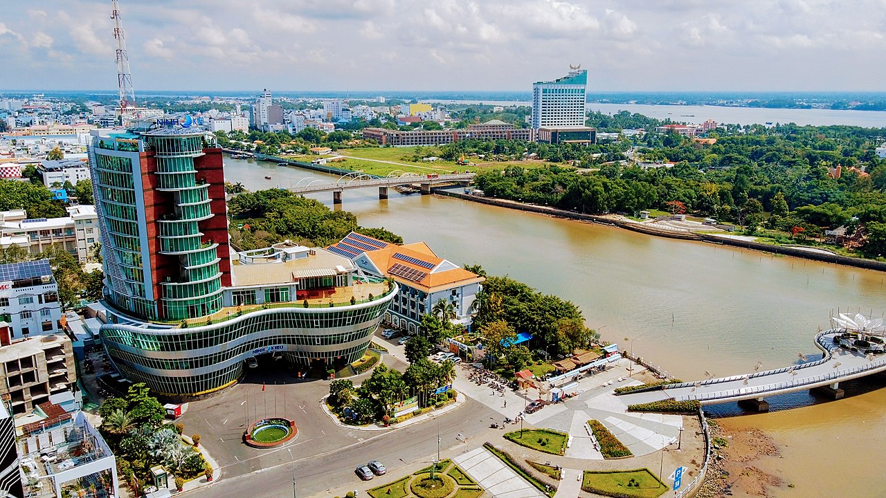
/kʌn tʌ/ • The Jewel of the Nine Dragon River
Experience the authentic pulse of Southern Vietnam through bustling waterways, verdant landscapes, and timeless river traditions.
Population
1.3M
Inhabitants
Land Area
1,439
Square KM
GDP Nominal
$11B
USD Nominal
Global Rank
399
Global City Rank
Real-time local weather, live currency rates, and airport transit router.
Perfect time to explore the city! Enjoy walking around Can Tho and discover its local parks, architectural marvels, and scenic avenues.
~20-40 minutes • Around 0 - 0 VND
Book via official ridesharing mobile applications where available to ensure fair rates!
~30-50 minutes • Around 0 - 0 VND • Runs frequently
Direct route connects airport terminal to major central stations.
Can Tho is a unique urban hub characterized by its complex network of canals and agricultural productivity.
Top Destination
Gateway to the Mekong Delta biodiversity.
High Yield
Renowned for rice and tropical fruit orchards.
Diverse
Blending Kinh, Khmer, and Chinese influences.
Growing
A vital commercial center for the region.
Can Tho's history is deeply intertwined with the development of the Mekong Delta as a fertile civilization.
Established as Tran Giang, a strategic military and trade post under the Nguyen Lords.
The French developed the city infrastructure and expanded canal networks for shipping.
The city became a critical administrative and educational center in Southern Vietnam.
Post-war, the city integrated fully into the Socialist Republic of Vietnam as a key provincial hub.
Can Tho was officially designated a municipality under the direct control of the central government.
Empirical charts mapping local seasonal variations, long-term urban population growth, and economic sector distribution.
Average temperatures (°C) against average monthly rainfall metrics (mm).
Source: Local meteorology department climatology records.
Historical urban concentration of the metropolitan area.
Source: Official national statistics historical database.
Percentage output breakdown of Can Tho's massive $11B economy.
Source: City Treasury economic forecast index.
From central buzz to rural calm, each district offers a different slice of life in the Delta.
Loading district dossier...
Navigate Can Tho's iconic monuments, royal historical locations, and prestigious world-class museums directly on our live interactive GIS mapping application.
Hover or tap on any of the map markers to read comprehensive descriptions, travel tips, and transport guidelines.
Iconic riverside walkway
Waterway trade hub
These iconic sites define the spirit and history of Can Tho.
Experience the vibrant wholesale trade on the Hau River at sunrise.
A stunning mix of French and Vietnamese architecture.
Ornate Khmer temple reflecting Buddhist traditions.
Recreation center showcasing Delta agricultural life.
Impressive engineering marvel crossing the Hau River.
A relaxing waterfront park, heart of city nightlife.
Can Tho cuisine highlights the freshness of river fish and tropical produce.
Rice noodle soup served with savory meat, herbs, and local toppings.
Crispy savory pancakes filled with shrimp, pork, and bean sprouts.
Grilled snakehead fish, a true local rustic specialty.
Sweet, chewy treats made from fresh Delta coconut milk.
Loading live transit database feed...
Plan your expenditures based on your preferred travel standard, and run live bidirectional currency conversions.
Change value in any currency field below to update all other fields synchronously based on realistic exchange coefficients.
How Can Tho compares to world cities.
| Metric | Can Tho | New York | London | |
|---|---|---|---|---|
| Housing | Low | Extreme | High | |
| Food | Cheap | Expensive | Moderate | |
| Transport | Low | Medium | Moderate |
Spread the knowledge! Share this masterclass encyclopedia of Can Tho with friends or colleagues.
Have questions about visiting, moving, or living in Can Tho? Ask local experts and fellow travelers.
View All Discussions →No active discussions for CAN-THO yet.
Be the first to ask a question or leave a tip for fellow travelers!
Expand your travel itinerary and economic comparison benchmarks by diving into our detailed GIS guides for neighboring hubs.